Global Hi Tech Survey
Chalakudy - Thrissur
Products & Services:
Global Hi Tech Survey, Chalakudy, Thrissur, Reviews, Contact number, Phone number, Address, Map, Sur More..
Since : 2006
Chalakudy - Thrissur
Products & Services:
Global Hi Tech Survey, Chalakudy, Thrissur, Reviews, Contact number, Phone number, Address, Map, Sur More..
Since : 2006
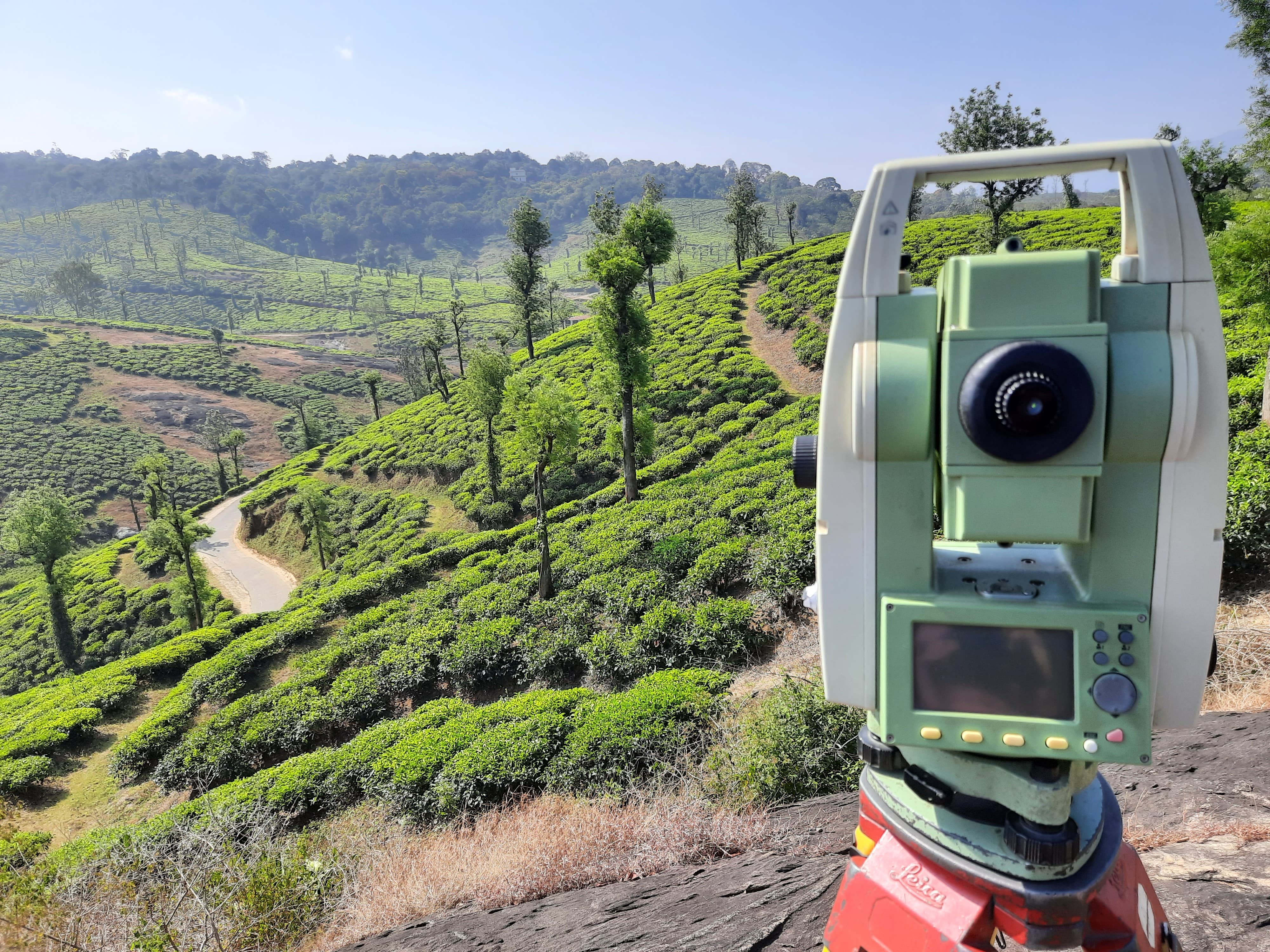
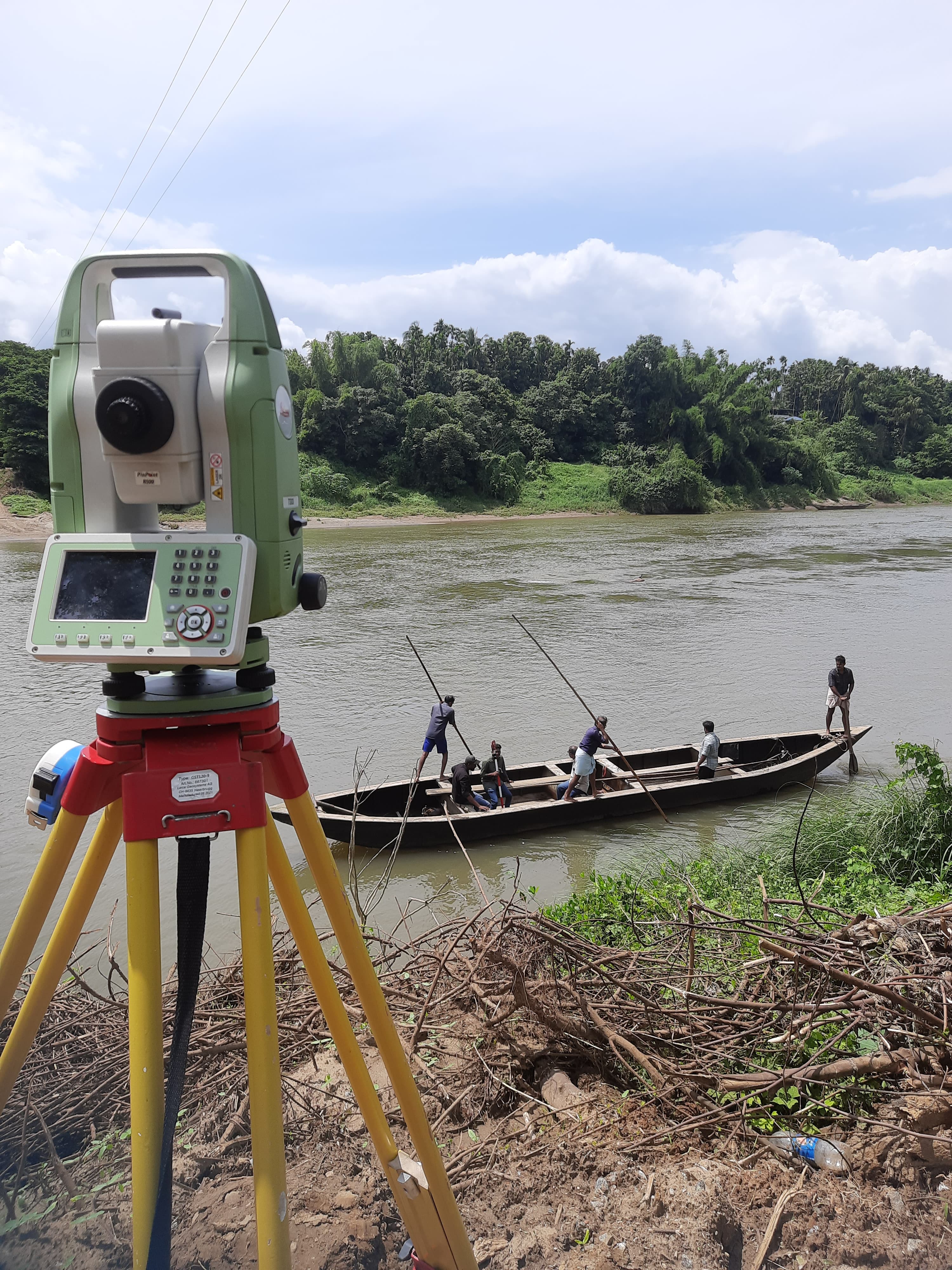
Enhance mining precision in Thrissur with our specialized Mining Satellite Survey. Focused on accuracy, our satellite surveys offer advanced solutions for efficient resource management, contributing to the overall excellence of mining projects.
Mining Satellite Survey in Thrissur emphasizes advanced satellite solutions. Our surveys leverage cutting-edge satellite technology to capture detailed and accurate geospatial data, supporting mining managers in making informed decisions for resource optimization.
Our team in Thrissur possesses expertise in satellite mapping for mining. Using advanced surveying techniques, we conduct Mining Satellite Surveys to ensure mining operations align with production targets and environmental considerations.
The survey is designed to optimize quarry operations using satellite technology. Accurate data from our Mining Satellite Surveys aids in planning and managing mining resources, contributing to the overall efficiency and sustainability of the operation in Thrissur.
Our Mining Satellite Survey services in Thrissur are tailored to meet the specific needs of mining operations. We understand the importance of advanced satellite solutions for successful resource management and quarry optimization.
Experience comprehensive data collection through our Mining Satellite Surveys. From stockpile measurements to topographical details, our satellite surveys offer insights essential for planning and managing mining resources effectively.
Q1: What is a Mining Satellite Survey, and why is it crucial in Thrissur? A: A Mining Satellite Survey involves advanced satellite data collection, providing accurate information for optimal resource management in Thrissur.
Q2: How does the survey ensure accuracy in mining quantity measurements in Thrissur? A: We utilize cutting-edge satellite technology and surveying tools to ensure high precision in mining quantity measurements, providing reliable data for mining managers.
Q3: Can Mining Satellite Surveys contribute to environmental considerations in Thrissur? A: Yes, accurate data from our surveys supports environmentally conscious mining operations by providing insights into resource usage and conservation.
Q4: What information is included in a Mining Satellite Survey for resource optimization? A: Information includes stockpile measurements, topographical details, and other data crucial for optimizing mining resources and ensuring production targets are met.
Q5: How does the satellite survey support efficient mining operations in Thrissur? A: Advanced satellite data aids in planning and executing efficient mining operations, contributing to the overall effectiveness of resource management.
Q6: Can the survey be customized for different types of mining projects in Thrissur? A: Yes, Mining Satellite Surveys are adaptable to various mining projects, supporting different sizes and specifications based on the unique requirements of each operation.
Q7: How long does it take to complete a Mining Satellite Survey in Thrissur? A: The duration varies based on the size and complexity of the mining operation, but our satellite surveys are conducted efficiently to provide timely and accurate geospatial data.
Elevate your mining operations in Thrissur with our Mining Satellite Survey. Contact us today for advanced satellite solutions that support efficient resource management and quarry optimization.
Thrissur, Chalakudy
Thrissur, Chalakudy
Latest Customer Reviews
"Very good service in drone survey & DGPS"
