Global Hi Tech Survey
Chalakudy - Thrissur
Products & Services:
Global Hi Tech Survey, Chalakudy, Thrissur, Reviews, Contact number, Phone number, Address, Map, Sur More..
Since : 2006
Chalakudy - Thrissur
Products & Services:
Global Hi Tech Survey, Chalakudy, Thrissur, Reviews, Contact number, Phone number, Address, Map, Sur More..
Since : 2006
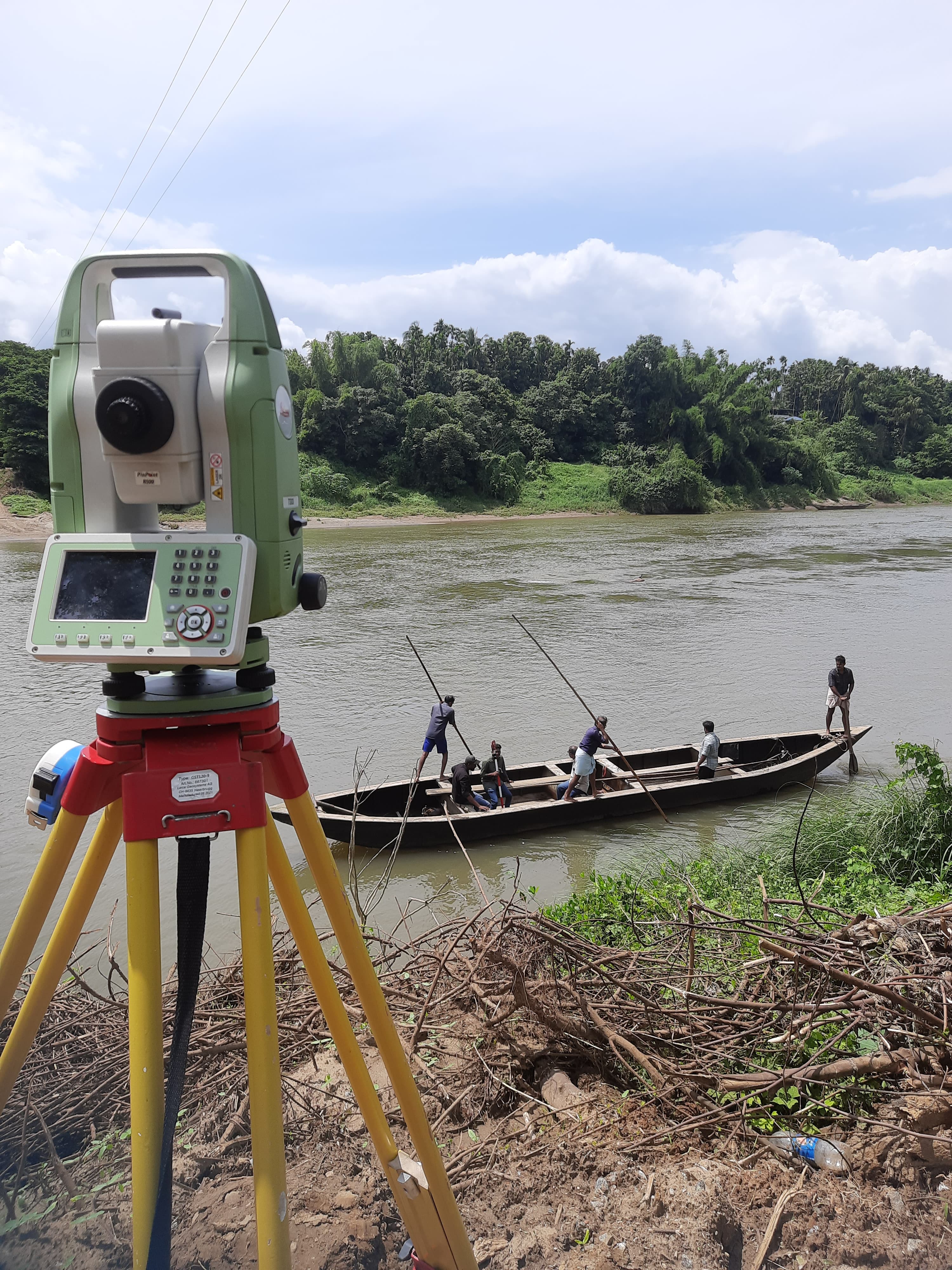
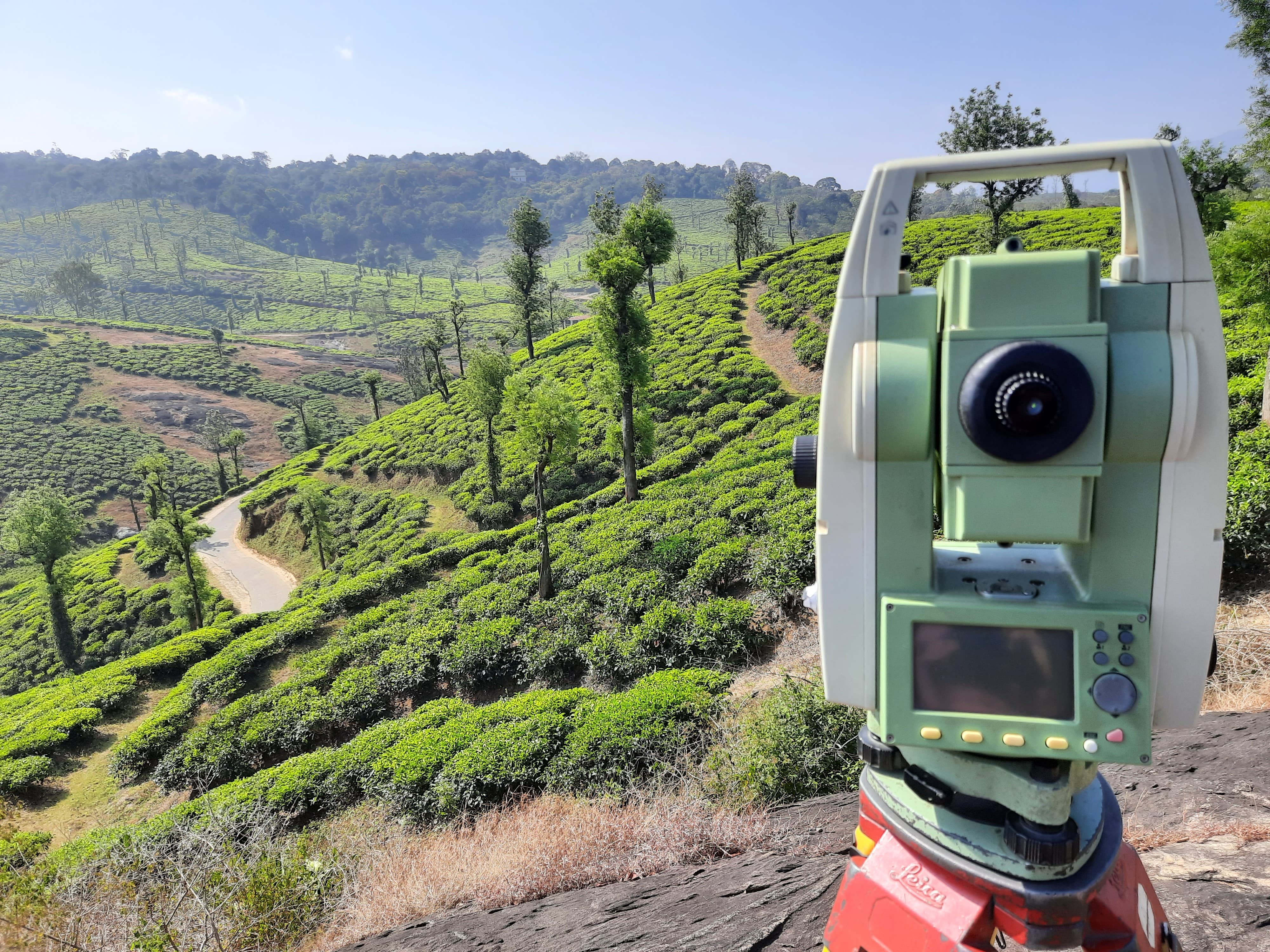
Embark on a journey of precision with our GPS Survey services in Thrissur. Utilizing advanced satellite positioning technology, we offer accurate geospatial insights for various applications.
GPS Survey in Thrissur guarantees accurate geospatial data collection. The integration of satellite positioning technology ensures reliable mapping and spatial information for diverse surveying needs.
Our surveying in Thrissur relies on satellite positioning technology to achieve high accuracy. GPS Survey enhances the efficiency of data collection, providing detailed insights for informed decision-making.
Experience excellence in land surveying with our GPS Survey services. We prioritize precision mapping, catering to the needs of construction projects, urban planning, and environmental assessments.
Our GPS Survey solutions in Thrissur are comprehensive, covering a wide range of applications. Whether it's topographic mapping, construction site planning, or environmental impact assessments, our surveys deliver accurate results.
Precision mapping is the cornerstone of our GPS Survey services. The accurate geospatial data collected empowers decision-makers with the insights needed for strategic and informed choices.
Q1: What is GPS Survey, and how does it work? A: GPS Survey utilizes satellite positioning technology to accurately map and collect geospatial data, ensuring precise results for land surveying.
Q2: Why is GPS Survey important for land surveying in Thrissur? A: GPS Survey ensures accuracy in geospatial data collection, providing crucial information for land surveying projects and various applications.
Q3: How does GPS technology enhance the accuracy of land surveys in Thrissur? A: GPS technology utilizes satellite signals to determine precise locations, enhancing the accuracy of land surveys even in challenging terrains.
Q4: Can GPS Survey be used for both small and large-scale projects in Thrissur? A: Yes, GPS Survey is versatile and suitable for projects of all scales, offering accuracy for both small and large-scale land surveying initiatives.
Q5: What level of accuracy can be achieved with GPS Survey in Thrissur? A: GPS Survey typically achieves sub-meter to centimeter-level accuracy, depending on the specific requirements of the surveying project.
Q6: How long does it take to complete a GPS Survey in Thrissur? A: The duration varies based on project size and complexity, but GPS Surveys are conducted efficiently to provide timely and accurate results.
Q7: Is the geospatial data collected through GPS Survey secure and confidential? A: Yes, the security and confidentiality of geospatial data collected through GPS Survey are prioritized, and measures are in place to protect sensitive information.
Maximize the accuracy of your geospatial data with our GPS Survey services in Thrissur. Contact us today to leverage cutting-edge technology for precise and informed land surveying.
Thrissur, Chalakudy
Thrissur, Chalakudy
Latest Customer Reviews
"Very good service in drone survey & DGPS"
