Global Hi Tech Survey
Chalakudy - Thrissur
Products & Services:
Global Hi Tech Survey, Chalakudy, Thrissur, Reviews, Contact number, Phone number, Address, Map, Sur More..
Since : 2006
Chalakudy - Thrissur
Products & Services:
Global Hi Tech Survey, Chalakudy, Thrissur, Reviews, Contact number, Phone number, Address, Map, Sur More..
Since : 2006
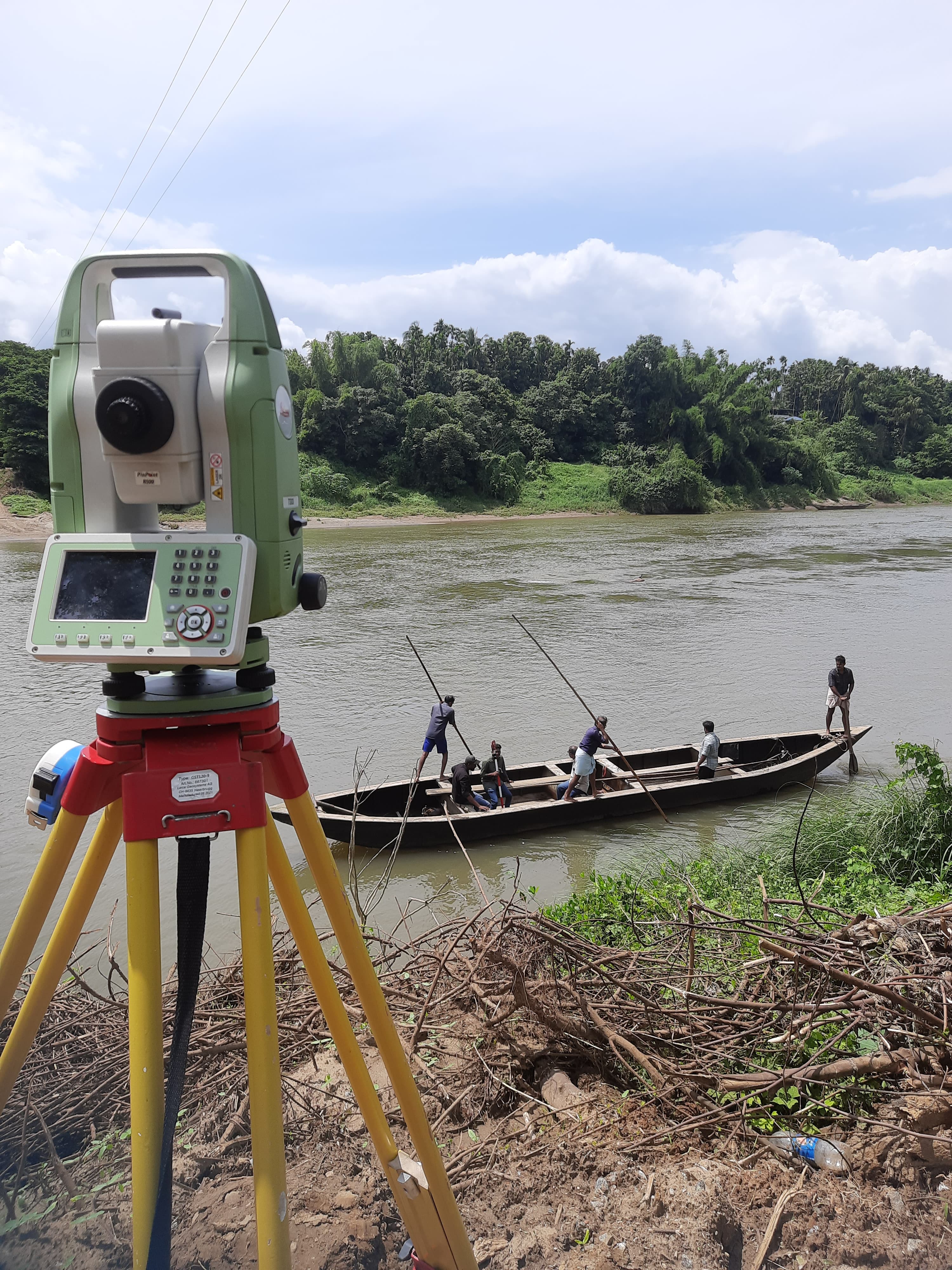
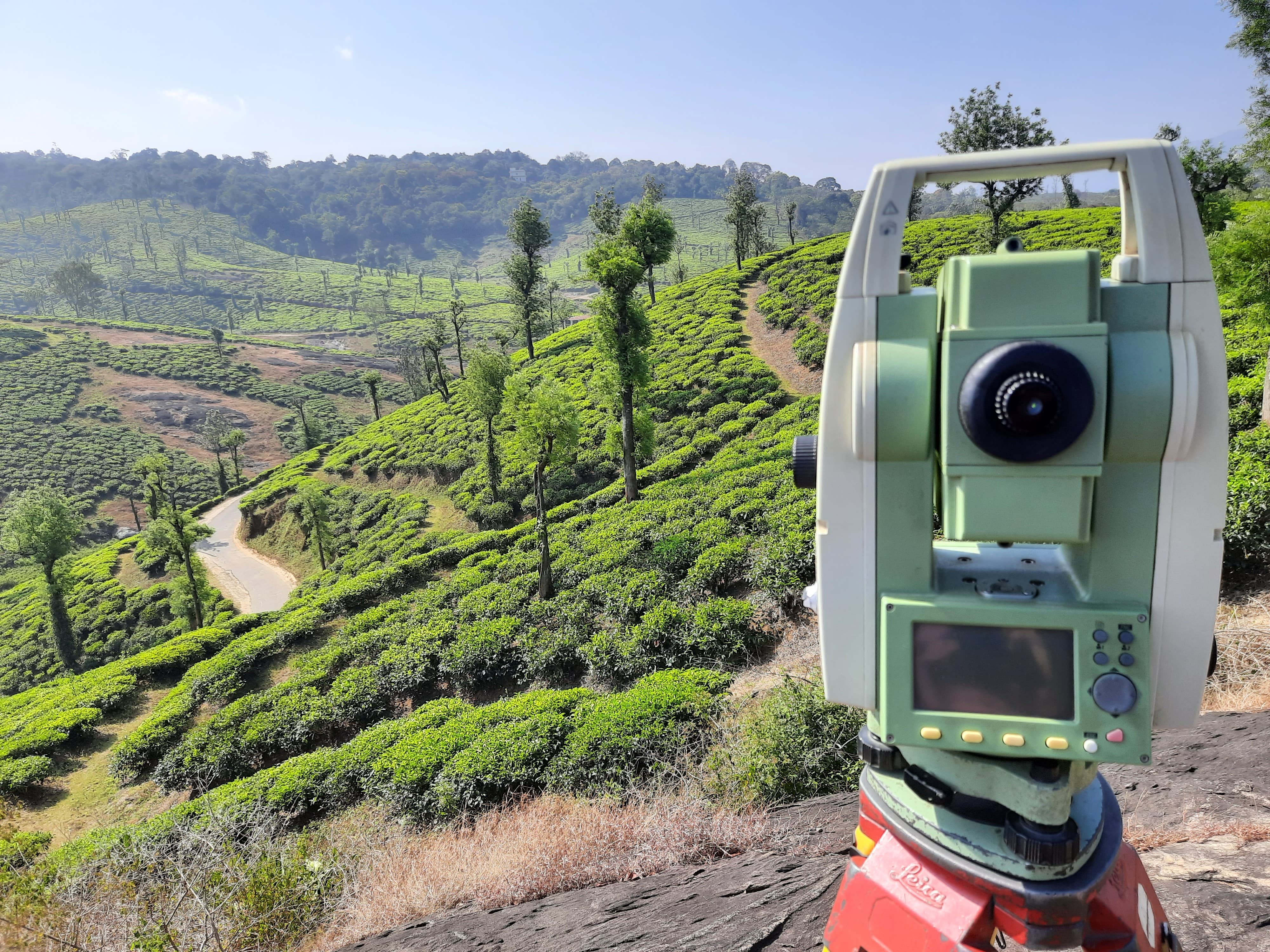
Unlock the potential of your land development projects with our Contour Survey services in Thrissur. This advanced surveying technique provides detailed topographic information, essential for informed decision-making.
Contour Surveys in Thrissur offer accurate terrain mapping, depicting the elevation and shape of the land. This information is crucial for various applications, including construction, urban planning, and environmental assessments.
Our team in Thrissur specializes in topographic surveys, ensuring that your Contour Survey is conducted with precision. We utilize advanced equipment to capture elevation data with high accuracy.
Contour Surveys play a vital role in optimizing land development. The detailed mapping of contours allows for better planning, minimizing challenges and maximizing the potential of the terrain.
Access comprehensive elevation data through our Contour Survey services. This information empowers developers, planners, and engineers to make informed decisions, leading to more efficient and successful projects.
Tailor our Contour Survey services to your specific project needs in Thrissur. Whether it's a small-scale construction project or a large-scale development, our surveys are customizable to suit your requirements.
Q1: What is a Contour Survey, and how does it work? A: A Contour Survey maps the elevation of the land, creating contour lines to represent changes in terrain. It involves measuring points of equal elevation.
Q2: Why is a Contour Survey important for land development? A: Contour Surveys provide crucial information about the terrain's elevation, helping optimize land development plans and mitigate potential challenges.
Q3: How accurate is the elevation data collected in a Contour Survey? A: The accuracy of elevation data in a Contour Survey is high, ensuring reliable information for land development projects.
Q4: Can Contour Surveys be conducted on any type of terrain in Thrissur? A: Yes, Contour Surveys are versatile and can be conducted on various terrains, including flat areas and more complex landscapes.
Q5: How long does it take to complete a Contour Survey in Thrissur? A: The duration varies based on the size and complexity of the area surveyed, but Contour Surveys are generally conducted efficiently.
Q6: Can Contour Surveys help identify potential drainage issues on a property? A: Yes, Contour Surveys reveal the natural drainage patterns of the land, helping identify and address potential drainage issues.
Q7: Is the data collected in a Contour Survey secure and confidential? A: Yes, the security and confidentiality of Contour Survey data are prioritized, and measures are in place to protect sensitive information.
Optimize your land development endeavors in Thrissur with our Contour Survey services. Contact us today to leverage precise terrain mapping for your next project.
Thrissur, Chalakudy
Thrissur, Chalakudy
Latest Customer Reviews
"Very good service in drone survey & DGPS"
